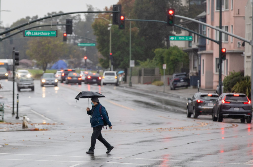

A moisture-rich storm system known as an atmospheric river is making its way across the San Francisco Bay Area Sunday morning and is expected to intensify and deliver the heaviest rain Sunday night into Monday, the National Weather Service said.
Heavy rain, small hail, low-elevation snow and thunderstorms are all in the mix with this system that could bring up to 3 inches of rain to urban areas including San Francisco and Oakland.
“There are multiple phases to this storm,” said Drew Peterson, a meteorologist with the weather service’s Monterey office. “The first phase is happening now with lesser impacts. We’re going to start to see the second phase of the storm unfold later today … The storm is going to intensify … beginning this evening through the overnight area into Monday. That’s when we’re going to get the heaviest rain rates.”
Storm systems in the greater Bay Area often bring the more rain to the North Bay than other areas, but with this event the heaviest precipitation is expected south of the region in the Santa Cruz and Santa Lucia mountains, where mudslides are possible. Scattered rain is forecast to continue into Tuesday; a second colder storm arrives mid-week bringing light rain and snow and bone-chilling temperatures that could approach freezing in inland valleys.
630AM weather update –
Rain over the Bay Area & cold across interior Central CoastExpect the storm to stall over Bay Area & Santa Cruz mtns today
The storm will intensify tonight to Mon & bring heavy rain and strong winds btwn SCZ mtns& Cent Coast
Postfrontal showers Mon-Tue pic.twitter.com/F9wioRUjLF
— NWS Bay Area (@NWSBayArea) December 12, 2021
Atmospheric rivers are long, narrow bands of water vapor — about 300 to 400 miles wide and 500 to 1,000 miles long — that form over an ocean and flow through the sky. It’s common for these systems to get hung up in mountainous terrain and dump copious amounts of rain in a focused area. Peterson said models are showing that this storm could bring 8 to 11 inches of rain to the highest peaks of the Santa Cruz and Santa Lucia mountains.
Peterson said forecasters are keeping a close eye on rainfall rates in these areas that are susceptible to mudslides in wildfire burn scars.
“The peak time to watch for heavier rainfall rates appears to be from late tonight into tomorrow evening, with a particular emphasis on monitoring the CZU, Dolan, and River burn scars for potential impacts,” the weather service said Sunday in its forecast.
Thunderstorms could develop in the wake of the storm on Monday and Tuesday, and Peterson said these are most likely to occur in the North Bay.
Snow levels are expected to drop to 2,500 to 3,200 feet Monday night into Tuesday with the tallest peaks, such as Mount St. Helena and Mount Hamilton, likely to receive anywhere from a dusting to up to 2 inches of snow.
The active pattern is expected to persist into Wednesday and Thursday when a weaker, colder storm than the atmospheric river moves across the region.